Countries Under Water
These islands will be uninhabitable within 30 years. Their governments are already planning for it.
The 30-year line is Tuvalu’s contingency, not an IPCC disappearance date. The plan is a visa cap, raised land, and a state that continues if the land does not.
Three numbers
- 0.5 metres — the World Meteorological Organization’s lower estimate of global sea-level rise by 2100. Pessimistic cases reach about 2 metres. Source: WMO, via UN.
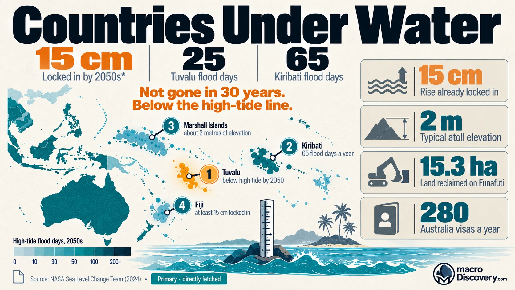
- 280 — Tuvalu citizens a year who can move to Australia under the Falepili Union. Population is about 11,000. Source: the treaty.
- About 2 metres — typical elevation of Tuvalu, Kiribati, and the Marshall Islands. The Maldives averages about 1.5 metres. Source: UN and national descriptions.
What the data shows
A common claim is that these islands will be uninhabitable within 30 years, and that their governments are already planning for it. The planning is real. The date is a contingency, not a disappearance scheduled by the climate panel. At COP27 in 2022, Tuvalu’s finance minister said that on current emissions the majority of the country’s land could be submerged by 2050 and deemed uninhabitable. That is a government reading of a high-emissions path. The Intergovernmental Panel on Climate Change says global mean sea level will keep rising through this century, and would take centuries to reverse even if emissions turned sharply negative.
The measured threat is flooding and salt, not a country vanishing on a calendar date. The World Meteorological Organization puts the rise at a minimum of 0.5 metres by 2100, and about 2 metres in pessimistic cases. Tuvalu, Kiribati, and the Marshall Islands sit about 2 metres above the sea. The Maldives averages about 1.5 metres. A half-metre rise does not cover a 2-metre island. It does push storms and high tides over the land, and it pushes salt into the freshwater lens people drink. Habitability can fail while land is still above the mean tide. Local rise is uneven. Seas around Tuvalu are reported up about 21 centimetres in 30 years, close to twice the global average.
The plans are narrower than a full evacuation. Tuvalu and Australia signed the Falepili Union in 2023. Australia recognized Tuvalu’s statehood even if seas rise, and opened a visa for up to 280 people a year to live, work, and study. At that cap, moving a population of about 11,000 would take about 40 years. Tuvalu also amended its constitution to keep its maritime zones and announced a digital-nation archive. A coastal project has raised about 7 hectares of land. Kiribati bought about 22 square kilometres in Fiji in 2012, first for food and workers, later as a possible refuge. None of these is a completed move.
The visa is a pathway, not a forecast that everyone leaves. Tuvalu’s public line is that people want to stay.
| Count | Figure | What it is |
|---|---|---|
| Sea-level rise by 2100 | at least 0.5 m | WMO lower estimate. Pessimistic cases about 2 m |
| Atoll elevation | about 2 m | Tuvalu, Kiribati, Marshall Islands |
| Tuvalu contingency | 2050 | Government worst case. Not an IPCC date |
| Falepili visas | 280 a year | Australia pathway. Population about 11,000 |
| Kiribati land in Fiji | 22 km² | Bought in 2012. Not a completed move |
How it was measured
Global mean sea level is a tide-gauge and satellite average. A local rate can be higher. Elevation is the height of the land above current mean sea level, not a promise of dry ground in a storm. Uninhabitable is a judgment about freshwater, food, and flooding. It is not the same as fully submerged.
The Falepili cap is a treaty number, 280 people a year. It is not a count of people who have moved. The 2050 line is a minister’s statement of a high-emissions case. It is not a year the IPCC has set for the last resident to leave.
What it means
It is settled that these atolls are about 2 metres high, that seas are projected to rise at least 0.5 metres by 2100, and that Tuvalu has a 280-person visa and a statehood clause. It is not settled that the islands will be uninhabitable within 30 years. Use 0.5 metres for the lower 2100 rise. Use 280 for the annual pathway. Use 2050 only as Tuvalu’s contingency. Do not use it as a disappearance date.
Common misreadings
- 2050 is a government worst case, not an IPCC date for the country to vanish.
- A 0.5-metre rise does not cover a 2-metre island. Flooding and salt can still make it hard to live on.
- The visa is 280 people a year. It is not a plan that has already moved the country.
Where the numbers come from
How we built this
- Dataset: WMO sea-level range as cited by UN News; Tuvalu COP27 contingency; Falepili Union visa cap; Kiribati’s 2012 Fiji purchase.
- Scope: Habitability and planned mobility. Storm-by-storm damage and tourism counts excluded. 2050 is kept as a contingency, not a forecast date.
- Figures: 0.5 metres is the lower 2100 rise. 280 is the annual visa cap. About 2 metres is typical atoll elevation.